NASA ARSET: Detecting and Monitoring Sea Ice with SAR, Part 1/3
SAR for Detecting and Monitoring Floods, Sea Ice, and Subsidence from Groundwater Extraction
Part 1: Detecting and Monitoring Sea Ice with SAR
Trainers: Erika Podest (JPL)
Guest Speakers: Malin Johansson (The Arctic University of Norway)
Over the past decade shipping traffic in the Arctic has expanded rapidly and as Arctic sea ice recedes due to climate change, an increased number of vessels with low ice-class are venturing into the region. One hazard that these ships face is striking sea ice and among the most serious hazards is becoming surrounded and stuck in sea ice. The pressure of the ice on the ship’s hull can cause severe structural damage, which can lead to oil spills. The entrapped ship can also drift towards shallower waters resulting in grounding, endangering its crew, passengers, or cargo. In addition, the loss of sea ice makes coastlines become vulnerable to bigger waves from storms, leading to accelerated erosion that impacts people and wildlife. Detecting and monitoring sea ice can help identify areas at risk for ships and also help inform on mitigation strategies along coastal areas in the Arctic. This session will provide a summary of the theory of SAR for detecting sea ice followed by a demo using SAR data with the SNAP Toolbox to generate maps of sea ice.
-
 0:52
0:52
CosmicCanvas Chronicles: Painting Space Narratives
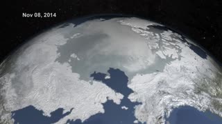
9 months agoArctic Sea Ice Breaks Records: NASA Observes New Winter Low
32 -
 1:50
1:50
Ufomania - the truth is out there
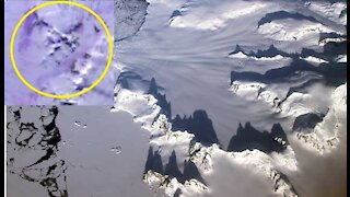
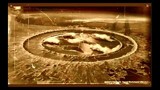
3 years ago $0.35 earnedSpy Satellite Detects an Ancient 12,000-Year-Old Structure Under Antarctica Ice
4.72K -
 23:13
23:13
United by Curiosity
1 year agoNew Discovery Under Antarctica's Ice That Scares Scientists!
19 -
 1:54
1:54
Events Happened
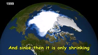
6 months agoNASA Warning - Arctic is Disappearing - Good or Bad???
170 -
 6:23
6:23
VictorHugoArt
1 year agoAntarctica Treaty Mystery Admiral Byrd USA Navy Exploration Hidden From Public Flat Earth Ice Wall
2781 -
 3:18
3:18
Eco Company Teens
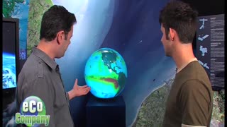
2 years agoNASA Studies the Oceans
2 -
 2:54
2:54
New Q. SGH SG Anon
1 year agoMilitary Confirms It Has No Idea Who Mapped Antarctica Before It Was Covered By The Ice-Cap
1.36K -
 2:54
2:54
Gene Decode
1 year agoMilitary Confirms It Has No Idea Who Mapped Antarctica Before It Was Covered By The Ice-Cap
1.44K5 -
 2:44:18
Book Club Analysis
11 months agoOn the Air/Sea/Space Arms Shows (Part 1/2)
118 -
 2:41:42
Book Club Analysis
11 months agoOn the Air/Sea/Space Arms Shows (Part 2/2)
111