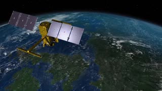
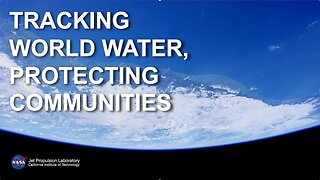
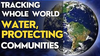
SWOT: Earth Science Satellite Will Help CommunitiesPlan for a Better Future
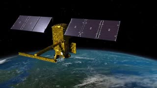
A new Earth science mission, led by NASA and the French space
agency Centre National d'Études Spatiales (CNES), will help
communities plan for a better future by surveying the planet's salt
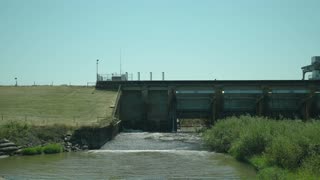
and freshwater bodies. The Surface Water and Ocean Topography
(SWOT) mission will measure the height of water in lakes, rivers,
reservoirs, and the oceans
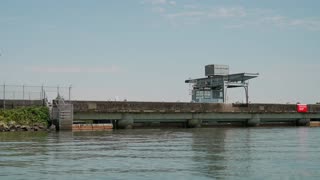
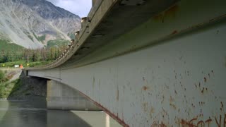
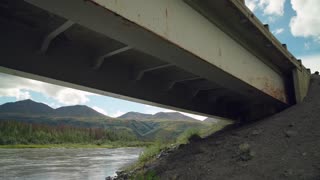
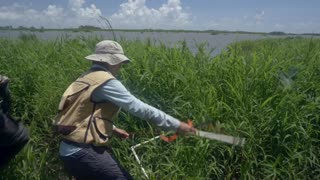
As climate change accelerates the water cycle, more communities
around the world will be inundated with water while others won't
have enough. SWOT data will be used to improve flood forecasts and
monitor drought conditions, providing essential information to water
management agencies, civil engineers, universities, the U.S
Department of Defense, disaster preparedness agencies, and others
who need to track water in their local areas. In this video, examples
of how SWOT data will be used in these communities are shared by a
National Weather Service representative in Oregon, an Alaska
Department of Transportation engineer, researchers from the
University of Oregon and University of North Carolina, a NASA Jet
Propulsion Laboratory scientist working with the Department of
Defense, and a JPL scientist working with the Louisiana Coastal
Protection and Restoration Agency.A new Earth science mission, led by NASA and the French space
agency Centre National d'Études Spatiales (CNES), will help
communities plan for a better future by surveying the planet's salt
and freshwater bodies. The Surface Water and Ocean Topography
(SWOT) mission will measure the height of water in lakes, rivers,
reservoirs, and the oceans
As climate change accelerates the water cycle, more communities
around the world will be inundated with water while others won't
have enough. SWOT data will be used to improve flood forecasts and
monitor drought conditions, providing essential information to water
management agencies, civil engineers, universities, th9e U.S
Department of Defense, disaster preparedness agencies, and others
who need to track water in their local areas. In this video, examples
of how SWOT data will be used in these communities are shared by a
National Weather Service representative in Oregon, an Alaska
Department of Transportation engineer, researchers from the
University of Oregon and University of North Carolina, a NASA Jet
Propulsion Laboratory scientist working with the Department of
Defense, and a JPL scientist working with the Louisiana Coastal
Protection and Restoration Agency.
#Trending#YouTubeViral#ViralContent#ShareThis#MustWatch#GoingViral#InstaViral#ViralTrend #astronomy #funny #cosmicjourney #funnyshorts #funnyvideo #nasa #science #spaceexploration #spacevideos #galacticwonders
-
 4:25
4:25
addy9490
9 months agoSWOT: Earth Science Satellite Will Help Communities Plan for a Better Future
19 -
 4:25
4:25
Khanbangashh
9 months agoSWOT: Earth Science Satellite Will Help Communities Plan for a Better Future
1 -
 4:25
4:25
WadeParker47
1 year agoSWOT: Earth Science Satellite Will Help Communities Plan for a Better Future
22 -
 4:25
4:25
NASA Stories
9 months agoSWOT: Earth Science Satellite Will Help Communities Plan for a Better Future
1 -
 1:50:29
VedioMix
9 months agoSWOT_ Earth Science Satellite Will Help Communities Plan for a Better Future (1)
-
 4:25
4:25
ZeemTv98
9 months agoSWOT: Earth Science Satellite Will Help Communities Plan for a Better...
10 -
 4:25
4:25
MrEthereum
9 months agoEarth Science Satellite Will Help Communities Plan for a Better Future
2 -
 4:25
4:25
Exploring the Universe with NASA
9 months agoEarth Science Satellite Will Help Communities Plan for a Better Future
4 -
 4:25
4:25
NasaSpaceVideosOfficial
9 months agoEarth Science Satellite Will Help Communities Plan for a Better Future
14 -
 4:25
4:25
"Smartainment Spectrum: Enlightening Entertainment and Knowledge Galore"
9 months agoSWOT: Earth Science Satellite Will Help Communities Plan for a Better Future
1